Visible City is an applied GIS (Geographic Information Systems) developer and practitioner group.(https://www.visible.city) The Visible City's team expertise extends across many aspects of planning for the man-built environment including insights into placement of real estate investments.
This post demonstrates several examples. (Visible City is currently collaborating with Wilkinson Building Advisors and the affiliated Sustainable Business Building Group's Building in a Box initiative). Here are some work product examples.
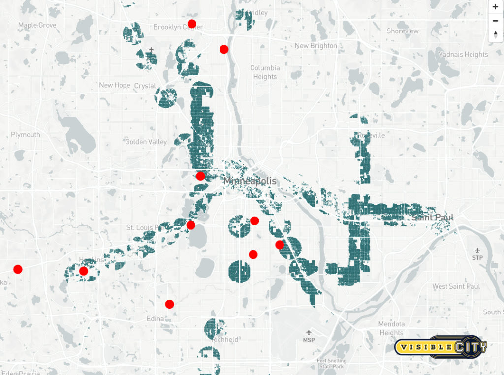
Historical Access to Transit
"The attached image illustrates locations of individual properties built 50 or more years ago, located within proximity of major existing or planned transit stations in the Minneapolis/St. Paul metro area. In several of these areas, the transit infrastructure is not yet in service, but the market is moving to account for its future impact. Those parties that incorporate more data into their decision making about operations and investments, stand to extend their competitive advantage." -Jon Commers http://www.visible.city
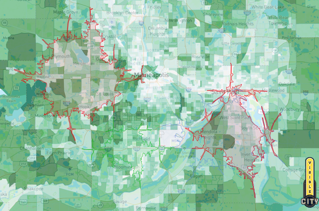
Accessibility studies
"Americans increasingly use transportation beyond the single-occupancy vehicle. Transit usage, shared car services, and micro-mobility options like scooters, are moving a growing share of passengers through the nation's metro areas. Spatial analysis and interpretation can help decision makers understand these patterns in order to reconsider what locations most strongly match their needs of today with contemporary consumer behavior. "
"(Re: suburban car access) The attached image illustrates the area of accessibility for given locations that an organization might compare - existing or prospective sites, or competitor's locations. The colored "travel-shed" represents the overall area from which a customer could reach the given location within a short period of time. Our approach is not only to establish the travel-shed, but to compare its characteristics - its community profile, its context in terms of building activity, transportation patterns, density of competition, and other metrics customized to a client's needs and strategy."-Jon Commers (Visible City's Managing Principal)http://www.visible.city
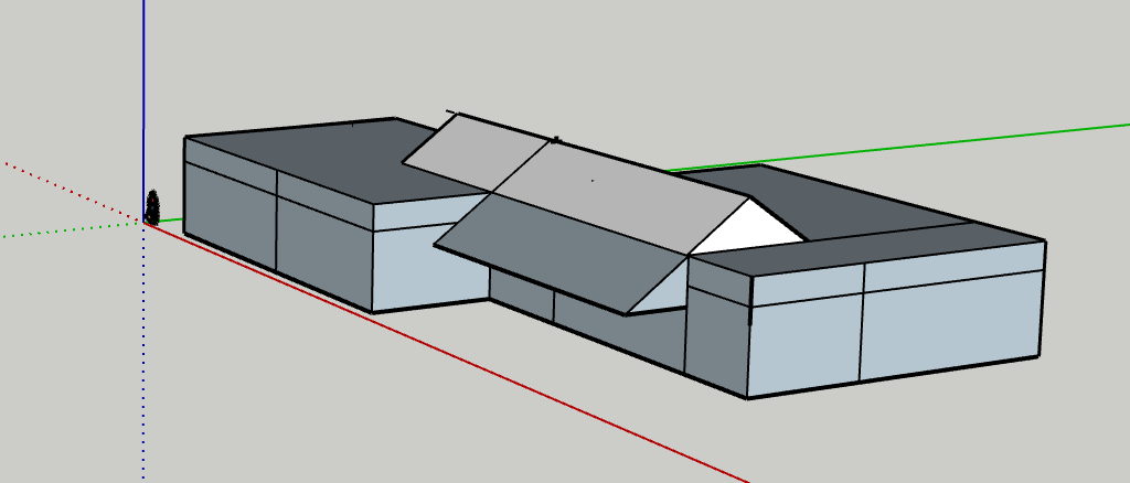
Small Sustainable Commercial prototype
Visible City and MSP real estate studies
Visible City is an applied GIS (Geographic Information Systems) developer and practitioner group.(https://www.visible.city) The Visible City's team expertise extends across many aspects of planning for the man-built environment including insights into placement of real estate investments.
This post demonstrates several examples. (Visible City is currently collaborating with Wilkinson Building Advisors and the affiliated Sustainable Business Building Group's Building in a Box initiative). Here are some work product examples.
Historical Access to Transit
"The attached image illustrates locations of individual properties built 50 or more years ago, located within proximity of major existing or planned transit stations in the Minneapolis/St. Paul metro area. In several of these areas, the transit infrastructure is not yet in service, but the market is moving to account for its future impact. Those parties that incorporate more data into their decision making about operations and investments, stand to extend their competitive advantage." -Jon Commers http://www.visible.city
Accessibility studies
"Americans increasingly use transportation beyond the single-occupancy vehicle. Transit usage, shared car services, and micro-mobility options like scooters, are moving a growing share of passengers through the nation's metro areas. Spatial analysis and interpretation can help decision makers understand these patterns in order to reconsider what locations most strongly match their needs of today with contemporary consumer behavior. "
"(Re: suburban car access) The attached image illustrates the area of accessibility for given locations that an organization might compare - existing or prospective sites, or competitor's locations. The colored "travel-shed" represents the overall area from which a customer could reach the given location within a short period of time. Our approach is not only to establish the travel-shed, but to compare its characteristics - its community profile, its context in terms of building activity, transportation patterns, density of competition, and other metrics customized to a client's needs and strategy."-Jon Commers (Visible City's Managing Principal)http://www.visible.city
Financial incentive information for Minnesota is provided by the Database of State Incentives for Renewables and Efficiency (DSIRE Minnesota) and State Energy Office contacts.